Get in touch
Let’s work together
If you’re looking for a partner that’s passionate, focused, and genuinely invested in unlocking your project’s potential, we want to hear from you.
A specialist group of geospatial companies, built for the world’s most complex infrastructure projects

From dam monitoring and tunnel condition assessments to mine surveys, rail corridors mapping, utility locating, and urban development, our capabilities give asset owners, engineers, and contractors a complete, reliable picture above and below ground.
Using advanced technologies in precision surveying, reality capture, imagery and LiDAR, all unified in IntelliSpatial, we turn complex spatial data into decisions your team can make with confidence.
One group. One solution. One platform. So every stakeholder, from field crew to boardroom, works from a single source of spatial truth.
With 40+ years of aerial survey experience, our Photomapping specialists deploy helicopter, and fixed-wing platforms equipped with advanced imaging and LiDAR – delivering precise, fit-for-purpose data at any scale, from high-resolution site detail to regional corridor mapping.


With 400+ specialists across the globe, our Land Surveys team delivers the full spectrum of survey capability – from cadastral and construction set-out through to reality capture, monitoring, and digital engineering – giving infrastructure leaders accurate, field-ready data to reduce risk and keep projects moving.

With specialist capability across GPR, electromagnetic locating, non-destructive digging, and 3D radar pavement surveys, our Utility Mapping team locates and maps what’s underground before it becomes a costly problem – delivering AS 5488-compliant data in formats ready for 12d, AutoCAD, BIM, and GIS workflows.

Designed for teams working across the asset lifecycle, from design and delivery to operations and maintenance, IntelliSpatial brings all your data into one platform so each stage becomes visible, trackable, and easy to interpret.


Live assets, constrained environments, long corridors, rarely straightforward.
We deliver end-to-end geospatial support from feasibility through to asset management, combining construction surveying, corridor mapping, tunnel scanning, and rail monitoring into one connected workflow.
This means safer operations, fewer unplanned shutdowns, and a complete picture of every asset, from first survey to long-term maintenance.
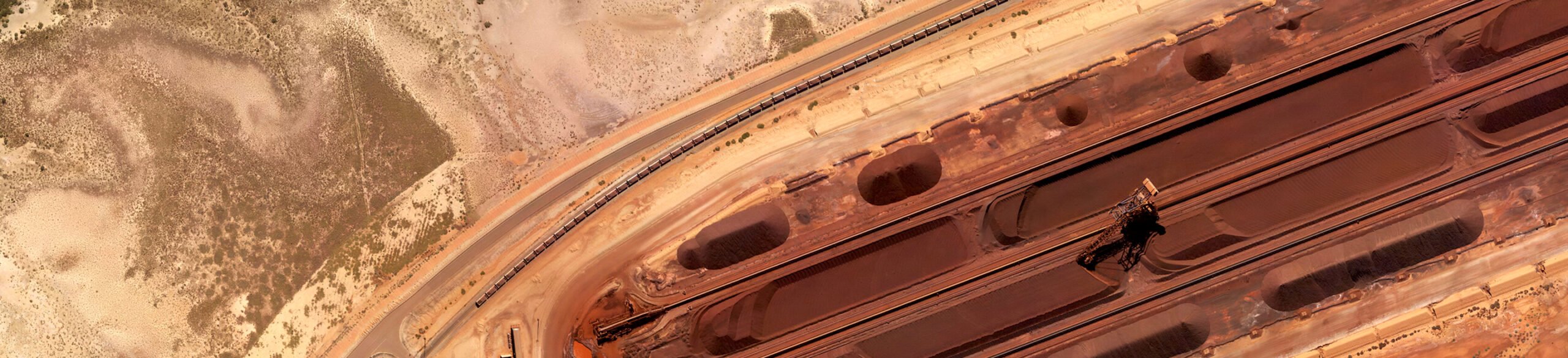
Remote sites, active operations, strict statutory obligations, from first peg to final rehabilitation.
We provide accurate, compliant surveying across the full mine lifecycle, from exploration and statutory surveys through to volumetric analysis, monitoring, and rehabilitation.
This means full statutory compliance, reduced operational risk, and the spatial confidence to make high-impact decisions at every phase.
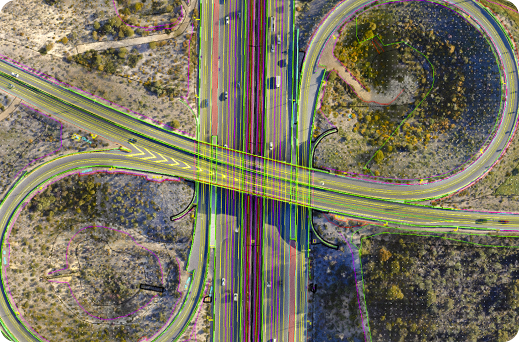
Tight timelines, boundary disputes, underground clashes, most of it avoidable with the right data upfront.
We support builders, engineers, and developers from site establishment through to final documentation, covering cadastral surveys, construction set-out, subsurface mapping, dilapidation surveys, and digital engineering under one roof.
This means fewer variations, smoother approvals, no underground surprises, and certified oversight from first peg to final sign-off.
Critical assets, live operations, incomplete legacy records, the stakes are high.
We take the uncertainty out of designing, constructing, and operating energy and utility assets, mapping what’s underground before you dig, monitoring what’s at risk, and connecting it all into one clear, reliable picture.
This means reduced site exposure, proactive risk management, and spatial data your engineers can act on, from feasibility to ongoing operations.


If you’re looking for a partner that’s passionate, focused, and genuinely invested in unlocking your project’s potential, we want to hear from you.